Jurisdiction
The Nunavik Marine Region includes all the marine areas, islands, lands and waters within the boundary identified in Schedule 3-2 of the Nunavik Inuit Land Claims Agreement (NILCA). The NMR boundary includes areas of equal use and occupancy with the Inuit of Nunavut, and areas of equal use and occupancy and joint ownership with the Cree of Eeyou Itschee. The NMR is further sub-divided into 3 pertinent zones, Zone A, Zone B, and Zone C.
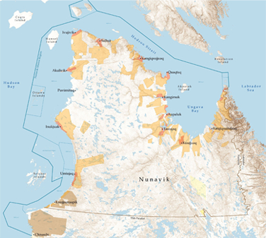
Nunavik is a territory that occupies a large landmass (660,000 square kilometers) within the tundra and sub-boreal regions above the 55th parallel in the Province of Québec . Nunavik covers an area that is equivalent to one-third the area of Québec.
Zone A
Zone A of the NMR is a sub zone of the NMR where the areas of equal use and occupancy with both the Inuit of Nunavut and the Cree of Eeyou Itschee, and a proportion of land retained by the Crown have been removed. Therefore, the NMR Zone A is an area where all lands are Nunavik Inuit Lands. For the authoritative boundary metes and bounds, please refer to Schedule 8-1 of the NILCA.
Zone A of the NMR however has three (3) exclusion parcels within the overall boundary which are portions of lands retained by the crown. NMR Zone A, Digges Island Exclusion Parcel (See Schedule 8-1b of NILCA) is a small portion of surveyed lands on the southern shore of Digges Island in Hudson Strait (north of Ivujivik). Aktpatok Island in Ungava Bay has three portions of surveyed lands that are exclusion parcels as they are retained by the Crown. Schedule 8-1c of NILCA depicts the Parcel 1 exclusion, Schedule 8-1d depicts the parcel 2 exclusion. Parcel 3 on Akpatok is a small portion of lands on the North west side of the island that was retained by the Crown due to an environmental concern.
Zone B
Zone B of the NMR is a sub zone of the NMR that represents an area of equal use and occupancy and joint ownership of lands with the Cree of Eeyou Itschee. All lands within Zone B are jointly owned by the Inuit and Cree less the following:
- Gillies Island per Certificate of Title 164, Nunavut Land Titles Office;
Zone C
Zone C of the NMR is a sub zone of the NMR that is a zone of equal use and occupancy, however, the majority portion of lands within the zone are owned by the Cree of Eeyou Itschee, less the following Nunavik Inuit Lands:
- 53°50’06” N Latitude and 79°07’59” W Longitude;
- 53°50’13” N Latitude and 79°04’11” W Longitude;
- 53°49’46” N Latitude and 79°04’27” W Longitude;
- 53°49’40” N Latitude and 79°05’00” W Longitude;
- 53°49’25” N Latitude and 79°05’35” W Longitude;
- 53°49’31” N Latitude and 79°07’20” W Longitude;
- 53°49’49” N Latitude and 79°08’00” W Longitude;
For greater certainty, included within the bounded area are the following named islands:
- Governor Island: the centre of which is located at approximately 53°49’45” N latitude and 79°06’00” W longitude
- Sam Island: the centre of which is located at approximately 53°50’00” N latitude and 79°06’00” W longitude; and
- Seal Islands: the centre of which is located at approximately 53°49’45” N latitude and 79°07’30” W longitude.